 Load Series
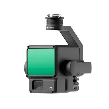
Zenmuse L2
The airborne high-precision mapping LiDAR integrates a frame-based LiDAR, a self-developed high-precision IMU, and 4/3 CMOS visible-light mapping cameras. With DJI Terra, it enables 3D data acquisition and high-precision post-processing.
Core Specifications
Product Video Introduction
Video sourced from the official DJI product page for reference.Zenmuse L2appearance and core functionality
* The video is an official DJI product video for reference on product form and features; actual configuration and pricing are subject to inquiry results.
Full Specifications
| Product Name | Zenmuse L2 |
| Size | Length: 155 mm, Width: 128 mm, Height: 176 mm |
| Weight | 905±5 g |
| System Power Consumption | 28 W (typical) 58 W (max) |
| Protection Rating | IP4 |
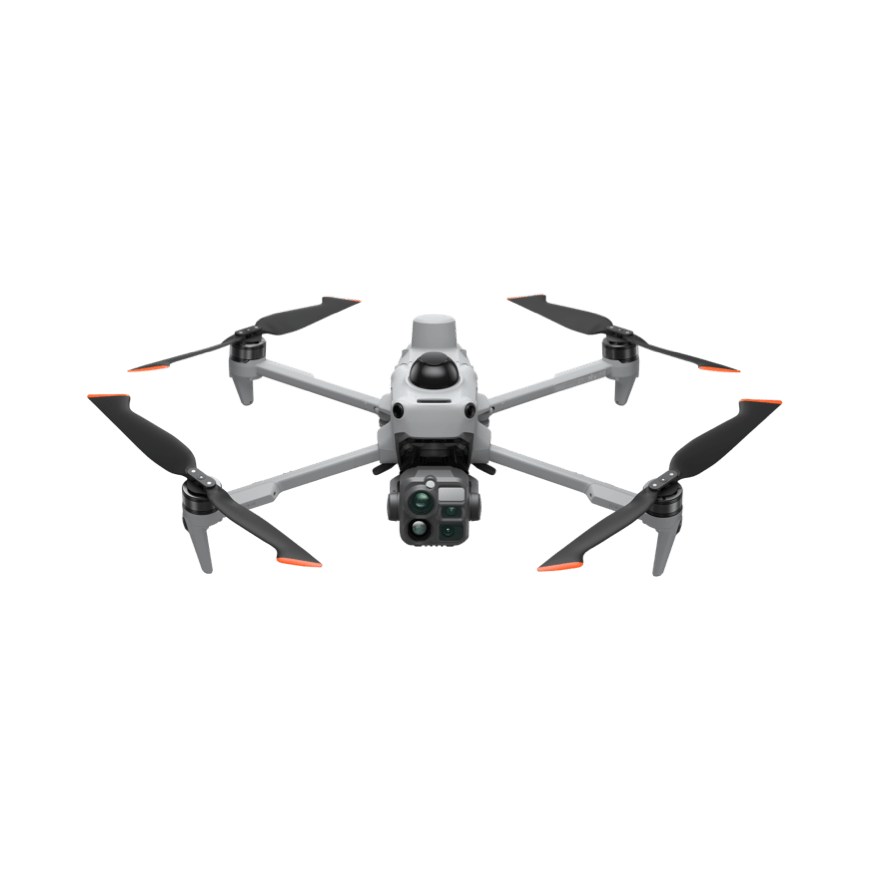
| Supported Models | Matrice 400 Matrice 350 RTK Matrice 300 RTK (requires DJI RC Plus controller) |
| Storage Temperature | -20°C to 60°C |
| Operating Temperature | -20°C to 50°C |
| System Performance · Range | 450 m (reflectivity 50%, 0 klx) 250 m (reflectivity 10%, 100 klx) Test conditions: flat target, target size larger than laser beam diameter, atmospheric visibility of 23 km, and vertical laser incidence. Note: Range is shorter on sunny days compared to cloudy days; if a single laser pulse hits multiple targets, the energy is dispersed, which may reduce the measurable distance. Measurement range stops at 500 m. |
| System Performance · Point Cloud Data Rate | Single echo: max 240000 points/sec | Multi-echo: max 1200000 points/sec |
| System Performance · System Accuracy | Horizontal accuracy: 5 cm @ 150 m; Vertical accuracy: 4 cm @ 150 m |
| System Performance · Real-time Point Cloud Coloring | Reflectance, Elevation, Distance, True Color |
| LiDAR · Range Accuracy (RMS 1σ) | Specific values depend on test conditions; please refer to actual measurements. |
| LiDAR · Maximum Supported Echo Count | 5 |
| LiDAR · Scan Mode | Non-redundant scan, Redundant scan |
| LiDAR · FOV | Repeat scan: Horizontal 70°, Vertical 3° Non-repeat scan: Horizontal 70°, Vertical 75° |
| LiDAR · Minimum Measurement Distance | 3 meters |
| LiDAR · Laser Divergence Angle | Horizontal divergence: 0.2 mrad, Vertical divergence: 0.6 mrad (measured at FWHM). 0.6 mrad indicates the laser beam diameter increases by 6 cm for every 100 meters of travel distance. |
| LiDAR · Laser Wavelength | 905 nanometers |
| LiDAR · Laser Spot Size | Horizontal 4 cm, Vertical 12 cm @ 100 m (FWHM) |
| LiDAR · Laser Pulse Emission Frequency | 240 kHz |
| LiDAR · Laser Safety Class | Class 1 (IEC 60825-1:2014) |
| LiDAR · Up to AEL | 233.59 nJ |
| LiDAR · Reference Aperture | Effective diameter 23.85 mm (equivalent circular) |
| LiDAR · 5 ns peak laser pulse emission power | 46.718 watts |
| Pose System · IMU Update Frequency | 200 Hz |
| Pose System · Accelerometer Range | ±6g |
| Pose System · Angular Velocity Measurement Range | ±300 dps |
| Pose System · Horizontal Positioning Accuracy | RTK FIX: 1 cm + 1 ppm |
| Pose System · Vertical Positioning Accuracy | RTK FIX: 1.5 cm + 1 ppm |
| Surveying Camera · Sensor | 4/3 CMOS, 2000 million effective pixels |
| Survey Camera · Lens | FOV: 84° | Equivalent Focal Length: 24 mm | Aperture: f/2.8 – f/11 | Focus Range: 1 m to Infinity (with Auto Focus) |
| Survey Camera · Shutter Speed | Mechanical shutter: 2 to 1/2000 sec; Electronic shutter: 2 to 1/8000 sec |
| Surveying Camera · Shutter Life | 20K |
| Survey Camera · Photo Dimensions | 5280 × 3956(4:3) |
| Surveying Camera · Photo Capture Mode & Parameters | Single Shot: 2000 MP Timed Photo: 2000 MP JPEG Timed Interval: 0.7/1/2/3/5/7/10/15/20/30/60 sec RAW/JPEG + RAW Timed Interval: 2/3/5/7/10/15/20/30/60 sec |
| Survey Camera · Video Encoding and Resolution | H.264, H.265 4K: 3840×2160 @ 30fps FHD: 1920×1080 @ 30fps |
| Surveying Camera · ISO | Video: 100 to 6400 Photos: 100 to 6400 |
| Survey Camera · Video Bitrate | 4K: 85Mbps FHD: 30Mbps |
| Survey Camera · Supports File System | exFAT |
| Survey Camera · Image Formats | JPEG/DNG (RAW) |
| Survey Camera · Video Format | MP4 (MPEG-4 AVC/H.264 or HEVC/H.265) |
| Gimbal Parameters · Stabilization System | 3 axis (pitch, roll, yaw) |
| Gimbal Parameters · Angle Jitter | 0.01° |
| Pan/Tilt Parameters · Mounting Method | DJI SkyPort Quick-Release |
| Gimbal Parameters · Mechanical Angle Range | Pitch: -143° to +43°, Yaw: ±105° |
| Pan Parameters · Controllable Rotation Range | Pitch: -120° to +30°, Yaw: ±90° |
| Gimbal Parameters · Working Mode | Follow / Free / Center |
| Data Storage · Raw Data Storage | Photos/IMU Point Cloud Data/GNSS Data/Calibration Files |
| Data Storage · Point Cloud Data Storage | Real-time modeling data storage |
| Data Storage · Supported Card Types | microSD card; supports up to 256GB capacity, sequential write speed ≥50MB/s, transfer speed up to UHS-I Speed Grade 3. Please use the recommended storage card. |
| Data Storage · Recommended Card Types | Lexar 1066x 64GB U3 A2 V30 microSDXC Lexar 1066x 128GB U3 A2 V30 microSDXC Kingston Canvas Go! Plus 128GB U3 A2 V30 microSDXC Lexar 1066x 256GB U3 A2 V30 microSDXC |
| Post-processing · Supported Software | DJI Terra |
| Post-processing · Data Format | DJI Terra supports exporting point cloud models in the following standard formats: PNTS/LAS/PLY/PCD/S3MB |
* Specifications are sourced from DJI's official product page; actual configurations may vary by factory. Prices are subject to inquiry.
Download Product Brochure
Below isZenmuse L2Product Brochure Preview: Click the button to generate and download a PDF version for internal review and selection archiving.
Airborne high-precision mapping LiDAR integrates a frame-based LiDAR, a high-precision self-developed IMU, and 4/3 CMOS visible-light mapping cameras. With DJI Terra, you can acquire 3D data and perform high-precision post-processing.
| Product Name | Zenmuse L2 |
| Size | Length: 155 mm, Width: 128 mm, Height: 176 mm |
| Weight | 905 ± 5 g |
| System Power Consumption | 28 W (typical) 58 W (max) |
| Protection Rating | IP4 |
| Supported Models | Matrice 400 Matrice 350 RTK Matrice 300 RTK (requires DJI RC Plus controller) |
| Storage Temperature | -20°C to 60°C |
| Operating Temperature | -20°C to 50°C |
| System Performance · Range | 450 m (reflectivity 50%, 0 klx) 250 m (reflectivity 10%, 100 klx) Test conditions: flat target, target size larger than laser beam diameter, atmospheric visibility of 23 km, laser incident vertically. Notes: Range is shorter on sunny days compared to cloudy days; if a single laser pulse hits multiple targets, the energy is distributed and the measurable distance may decrease. Measurement range stops at 500 m. |
| System Performance · Point Cloud Data Rate | Single echo: max 240000 points/sec | Multi-echo: max 1200000 points/sec |
| System Performance · System Accuracy | Horizontal accuracy: 5 cm @ 150 m; Vertical accuracy: 4 cm @ 150 m |
| System Performance · Real-time Point Cloud Coloring | Reflectance, Elevation, Distance, True Color |
| LiDAR · Range Accuracy (RMS 1σ) | Specific values depend on test conditions; please refer to actual measurements. |
| LiDAR · Maximum Supported Echo Count | 5 |
| LiDAR · Scan Mode | Non-redundant scan, Redundant scan |
| LiDAR · FOV | Repeated scan: Horizontal 70°, Vertical 3° Non-repeated scan: Horizontal 70°, Vertical 75° |
| LiDAR · Minimum Measurement Distance | 3 meters |
| LiDAR · Laser Divergence Angle | Horizontal 0.2 mrad, vertical 0.6 mrad measured at FWHM; 0.6 mrad indicates the laser beam diameter increases by 6 cm for every 100 meters of distance. |
| LiDAR · Laser Wavelength | 905 nanometers |
| LiDAR · Laser Spot Size | Horizontal 4 cm, Vertical 12 cm @ 100 m (FWHM) |
| LiDAR · Laser Pulse Emission Frequency | 240 kHz |
| LiDAR · Laser Safety Class | Class 1 (IEC 60825-1:2014) |
| LiDAR · Maximum Emission Limit (AEL) | 233.59 nJ |
| LiDAR · Reference Aperture | Effective diameter 23.85 mm (equivalent circular) |
| LiDAR · Peak Laser Pulse Emission Power Within 5 Nanoseconds | 46.718 W |
| Pose System · IMU Update Frequency | 200 Hz |
| Pose System · Accelerometer Range | ±6g |
| Pose System · Angular Velocity Measurement Range | ±300 dps |
| Pose System · Horizontal Positioning Accuracy | RTK FIX: 1 cm + 1 ppm |
| Pose System · Vertical Positioning Accuracy | RTK FIX: 1.5 cm + 1 ppm |
| Surveying Camera · Sensors | 4/3 CMOS, effective resolution 2000 megapixels |
| Surveying Camera · Lens | FOV: 84° | Equivalent Focal Length: 24 mm | Aperture: f/2.8 to f/11 | Focus Range: 1 m to Infinity (with Auto Focus) |
| Survey Camera · Shutter Speed | Mechanical shutter: 2 to 1/2000 sec; Electronic shutter: 2 to 1/8000 sec |
| Surveying Camera · Shutter Life | 20K |
| Survey Camera · Photo Dimensions | 5280 × 3956(4:3) |
| Surveying Camera · Photo Capture Mode & Parameters | Single shot: 2000 MP Timed shooting: 2000 MP JPEG timed interval: 0.7/1/2/3/5/7/10/15/20/30/60 sec RAW/JPEG + RAW timed interval: 2/3/5/7/10/15/20/30/60 sec |
| Survey Camera · Video Encoding and Resolution | H.264, H.265 4K: 3840×2160 @ 30fps FHD: 1920×1080 @ 30fps |
| Surveying Camera · ISO | Video: 100 to 6400 Photos: 100 to 6400 |
| Survey Camera · Video Bitrate | 4K: 85Mbps FHD: 30Mbps |
| Survey Camera · Supports File System | exFAT |
| Survey Camera · Image Formats | JPEG/DNG (RAW) |
| Survey Camera · Video Format | MP4 (MPEG-4 AVC/H.264 or HEVC/H.265) |
| Gimbal Parameters · Stabilization System | 3 axis (pitch, roll, yaw) |
| Gimbal Parameters · Angle Jitter | 0.01° |
| Pan-Tilt Parameters · Mounting Method | DJI SkyPort Quick-Release |
| Gimbal Parameters · Mechanical Angle Range | Pitch: -143° to +43° | Yaw: ±105° |
| Pan Tilt Parameters · Controllable Rotation Range | Pitch: -120° to +30° | Yaw: ±90° |
| Gimbal Parameters · Working Mode | Follow/Free/Center |
| Data Storage · Raw Data Storage | Photo/IMU/Point Cloud Data Storage/GNSS Data/Calibration Files |
| Data Storage · Point Cloud Data Storage | Real-time model data storage |
| Data Storage · Supported Card Types | microSD card; supports up to 256GB capacity, sequential write speed ≥50MB/s, transfer speed up to UHS-I Speed Grade 3. Please use the recommended storage card. |
| Data Storage · Recommended SD Card Types | Lexar 1066x 64GB U3 A2 V30 microSDXC Lexar 1066x 128GB U3 A2 V30 microSDXC Kingston Canvas Go! Plus 128GB U3 A2 V30 microSDXC Lexar 1066x 256GB U3 A2 V30 microSDXC |
| Post-processing · Supported Software | DJI Terra |
| Post-processing · Data Format | DJI Terra supports exporting point cloud models in the following standard formats: PNTS/LAS/PLY/PCD/S3MB |
Brochures are generated in real-time from page content. If your browser blocks the download, allow pop-ups and try again.
- Professional Scenario Selection Guide
- Customer Service Hotline 4006068166
- Building 7, Compound 2, Guanghua Road, Chaoyang District, Beijing
Purchase Intent
Submit your requirements and contact details. A sales consultant will confirm pricing, stock availability, and delivery options with you. Product prices are subject to quotation.