 Industry Drones
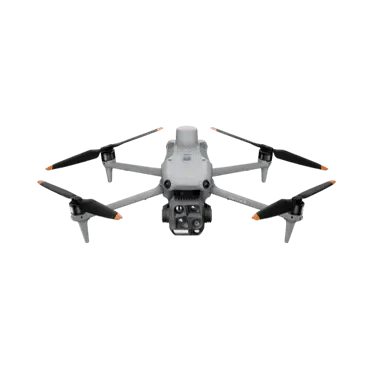
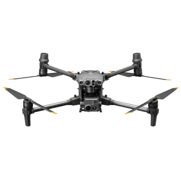
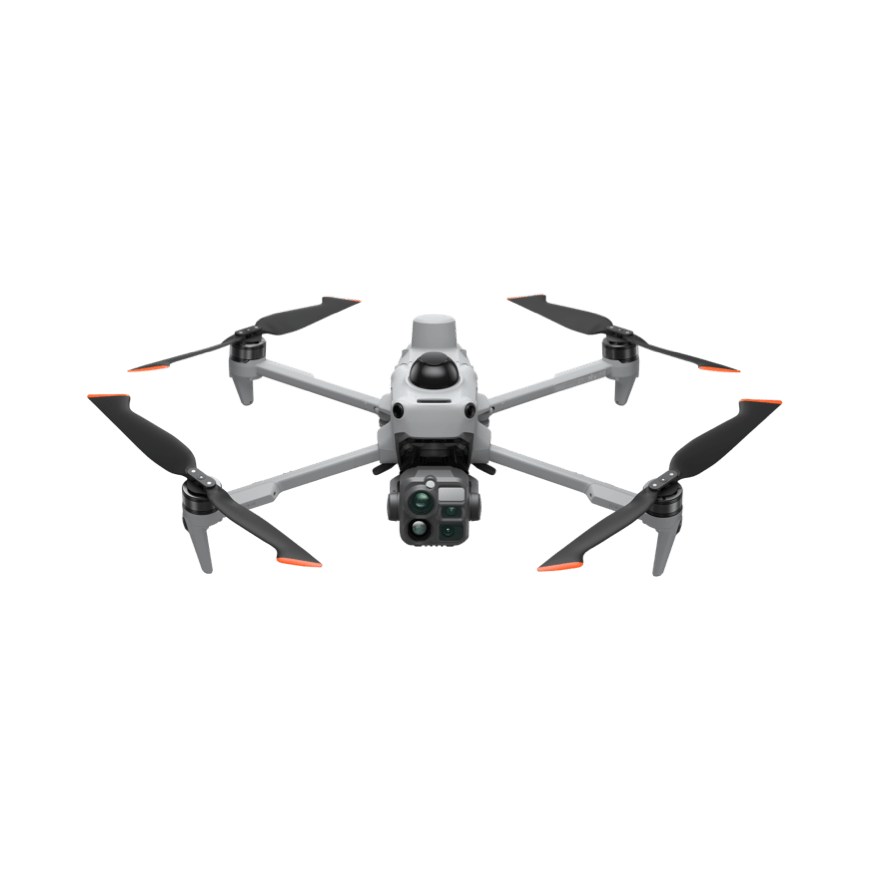
DJI Matrice 5T
All-scenario lightweight industrial drone integrating LiDAR, millimeter-wave radar, and full-color omnidirectional vision. Features IP55 protection and 59-minute flight time. Native 1K thermal imaging with infrared super-resolution delivers clear day-and-night imagery for emergency response, power & infrastructure inspection, and surveying. Supports open onboard computing and Pilot 2 plugin expansion.
Core Specifications
Use Cases
Power Inspection:Carry wide-angle, medium-telephoto, and telephoto triple cameras to autonomously follow transmission line routes. The telephoto camera captures detailed views of insulators, hardware, and conductors from a safe distance, while thermal imaging simultaneously detects abnormal temperature rises at connection points and displays real-time thermal images. A horizontal ring-scan LiDAR and millimeter-wave radar assist with obstacle avoidance in areas with dense towers and lines. With 59 minutes of flight time and 45 kilometers of range, the system covers long line sections, reducing the need for mid-flight returns for recharging.
Emergency Rescue:Ready to launch immediately upon arrival. Infrared super-resolution and black-and-white night vision assist in locating personnel and heat sources during nighttime or low-light conditions. Laser rangefinders measure target distance and position, while image transmission relays extend coverage in obstructed environments like mountains and canyons. With IP55 protection and wind resistance up to 12 m/s, the system operates reliably in complex weather including rain, snow, and sandstorms. Live video feeds are synced to command staff via Pilot 2 for situational awareness and resource deployment.
Full Specifications
| Chassis Weight | 2239 g (with battery, propellers, and microSD card) |
| Maximum Takeoff Weight | 2639 g |
| Size | Unfolded: 408 mm (L) x 507 mm (W) x 191 mm (H); Folded: 335 mm (L) x 155 mm (W) x 203 mm (H). Includes landing gear and gimbal; propellers not included. |
| Maximum Load | 400 g |
| Wheelbase | Diagonal: 572 mm |
| Longest Flight Time | 59 minutes (calculated in a windless environment with no payload, flying forward at approximately 9 m/s until 2% battery remains) |
| Longest hover time | 54 minutes (calm environment) |
| Maximum Range | 45 km (calm wind, flying forward at approx. 15 m/s) |
| Maximum horizontal flight speed | 23 m/s (forward flight in sport mode) |
| Maximum wind speed | 12 m/s (takeoff and landing phase) |
| Maximum Takeoff Altitude | 7000 m (max operating altitude with accessories: 4500 m) |
| Protection Rating | IP5 |
| Wide-angle camera | 1/0.98-inch CMOS, 5000 million effective pixels, equivalent focal length 23.5 mm, aperture f/1.8 |
| Mid-to-Telephoto Camera | 1/1.28-inch CMOS, 5000 million effective pixels, equivalent focal length 70 mm, aperture f/2.88 |
| Telephoto Camera | 1/1.5-inch CMOS, 5000 million effective pixels, equivalent focal length 252 mm, aperture f/2.8, 16x digital zoom (hybrid zoom up to 176x) |
| Thermal Imaging Camera | Uncooled vanadium oxide (VOx) detector with native resolution 1280×1024, infrared super-resolution 2560×2048@30fps, pixel pitch 8 μm, sensitivity ≤50 mK@F1.0, temperature range -20°C to 150°C (high gain) / 0°C to 550°C (low gain). |
| Laser Distance Measurement | Normal incidence range: 3000 m; Oblique incidence range: 1200 m; Blind zone: 1 m |
| Perception System | 6 360° omnidirectional fish-eye camera (top 4, bottom 2), horizontal scanning LiDAR, front/top/bottom tri-directional mmWave radar, and downward-facing ToF infrared sensor. |
| Video Transmission | DJI O4 Pro Video Transmission, CE/SRRC/MIC 20 km, Remote Controller with 3 channels supporting 1080p/30fps, latency of approximately 130 ms. |
| Battery | 10073 mAh / 21.36 V / Rated 215.2 Wh, Weight: 768 g, Cycles: 200 |
| Remote | DJI RC Plus 3 Enterprise Edition, 7.44-inch 1920×1440, 2000 nits display, Android 16, IP54 |
* Specifications are sourced from DJI's official product page; actual configurations may vary by factory. Prices are subject to inquiry.
Download Product Brochure
Below isDJI Matrice 5TProduct Brochure Preview: Click the button to generate and download a PDF version for internal review and selection archiving.
All-scenario lightweight industrial drone integrating LiDAR, millimeter-wave radar, and full-color omnidirectional vision. Features IP55 protection and 59-minute flight time. Native 1K thermal imaging with infrared super-resolution delivers clear day-and-night imagery for emergency response, power & infrastructure inspection, and surveying. Supports open onboard computing and Pilot 2 plugin expansion.
| Chassis Weight | 2239 g (with battery, propellers, and microSD card) |
| Maximum Takeoff Weight | 2639 g |
| Size | Expanded: 408 mm (L) × 507 mm (W) × 191 mm (H); Folded: 335 mm (L) × 155 mm (W) × 203 mm (H). Dimensions include landing gear and gimbal; propellers not included. |
| Maximum Load | 400 g |
| Wheelbase | Diagonal 572 mm |
| Longest Flight Time | 59 minutes (no-wind environment, no payload; flies forward at approximately 9 m/s until remaining battery is 0%) |
| Longest Hover Duration | 54 minutes (calm environment) |
| Maximum Range | 45 km (calm conditions, flying forward at approximately 15 m/s) |
| Maximum horizontal flight speed | 23 m/s (forward flight in sport mode) |
| Maximum wind speed | 12 m/s (takeoff and landing phase) |
| Maximum Takeoff Altitude | 7000 meters (max working altitude with accessories: 4500 meters) |
| Protection Rating | IP5 |
| Wide-angle Camera | 1/0.98-inch CMOS, 5000 effective megapixels, 35mm equivalent focal length: 23.5 mm, aperture f/1.8 |
| Medium-to-Telephoto Camera | 1/1.28-inch CMOS, 5000 effective megapixels, 35mm equivalent focal length: 70 mm, aperture f/2.88 |
| Telephoto Camera | 1/1.5-inch CMOS, 5000 million effective pixels, equivalent focal length 252 mm, aperture f/2.8, 16x digital zoom (hybrid zoom: 176x) |
| Thermal Imaging Camera | Uncooled vanadium oxide (VOx), native resolution 1280×1024, infrared super-resolution 2560×2048@30fps, pixel pitch 8 μm, sensitivity ≤50 mK@F1.0, temperature range -20°C to 150°C (high gain) / 0°C to 550°C (low gain). |
| Laser Distance Measurement | Normal incidence range: 3000 m, Oblique incidence range: 1200 m, Blind zone: 1 m |
| Perception System | 6 All-Directional Fisheye Vision (Top 4, Bottom 2), Horizontal 360° LiDAR, Front/Top/Bottom Tri-Axis Millimeter-Wave Radar, and Downward ToF Infrared Sensor |
| Video Transmission | DJI O4 Pro Video Transmission, CE/SRRC/MIC 20 km range; Remote controller supports 3 channels with 1080p/30fps video; Latency approx. 130 ms |
| Battery | 10073 mAh / 21.36 V / Rated 215.2 Wh, Weight 768 g, Cycles 200 |
| Remote | DJI RC Plus 3 Enterprise Edition, 7.44-inch 1920×1440, 2000-nits display, Android 16, IP54 |
Brochures are generated in real-time from page content. If your browser blocks the download, allow pop-ups and try again.
- Professional Scenario Selection Guide
- Customer Service Hotline 4006068166
- Building 7, Compound 2, Guanghua Road, Chaoyang District, Beijing
Purchase Intent
Submit your requirements and contact details. A sales consultant will confirm pricing, stock availability, and delivery options with you. Product prices are subject to quotation.
Related Cases
DJI Matrice 5TApplication records in real-world projects
 Emergency Rescue
Night mountain search by emergency rescue team in [Location]
During nighttime mountain search-and-rescue operations, the DJI Matrice 5T uses its thermal imaging and night vision capabilities to quickly survey forested areas and ravines. Laser rangefinding and image transmission relay sync real-time footage to the command center.
- Night search transitions from flat-area sweep to aerial zone scanning with ground verification. Suspicious heat signatures are instantly transmitted and marked at the command center; ground teams verify each marked segment sequentially, eliminating redundant back-and-forth trips.
- Video feeds from occluded gully areas remain available, enabling command personnel to adjust search priorities accordingly.
- Post-task, retain flight logs and trajectory records for mission review and personnel coordination analysis.
 Power Inspection
Drone inspection of transmission lines by a power supply unit
Leverage the DJI Matrice 5T as the primary platform to establish a multi-sensor inspection workflow for power transmission lines, covering routine inspections, defect verification, and nighttime emergency response. Capture visible light details, thermal temperature data, and LiDAR ranging measurements simultaneously in a single flight.
- Routine inspections are scheduled by zone. Each takeoff and landing now covers longer tower sections than before, reducing the number of trips required for recharging.
- Defect review: Operations staff perform initial screening on imagery and thermal images, then schedule tower climbs to minimize unnecessary visits.
- Rapid emergency inspections can be deployed on-site during severe weather to provide real-time visuals and location references for抢修 efforts.